Yungay, Also Called Yungay Hermosura


Yungay, Ancash, Peru
Suggest Place to Visit
657
Track to location with GPS |
 |
Yungay already existed since pre-Inca times. The first written references refer to its name from the time of the Inca Viracocha and Pachacútec towards the 1400s.
It was visited for the first time by the Spanish conquerors in 1533, who on August 4, 1540 founded the city of Yungay and the convent of Santo Domingo de Yungay, at the initiative of Father Domingo de Santo Tomás, the same one who was elevated to the category of Vicariate in 1579; The first glacial catastrophe recorded in the History of Ancash occurred on January 6, 1725 as a result of a terrible earthquake, the town of Ancash disappearing.
On January 20, 1839, the Battle of Yungay took place, in which the Peru-Bolivia Confederation was dissolved with the victory of the United Peru-Chile Restorer Army. It was as a result of this battle that was carried out in the Ancash river ravine, for which the Ancash name was given to the Department of Huaylas, changing its name to the Department of Ancash.
In April 1843, the hordes of Atusparia (20,000 men) attacked Yungay, whose inhabitants defended their homeland, after fierce fighting, on the fourth day, Atusparia took the city with blood and fire.
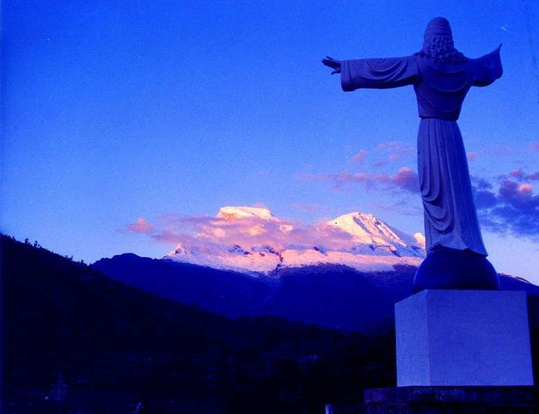
Other important events were: the conversion into the Yungay Province took place on October 28, 1904 with Law 006; the construction of the architectural jewel of the city's cemetery by designed by the Swiss architect Arnoldo Ruska and the sculptor Filomeno Melgarejo; the beginning of the procedures in 1962 for the creation of the Huascarán National Park promoted by the Yungaino Dr. Artemio Angeles Figueroa from the Presidency of the Ancash Club; and the earthquake-avalanche that destroyed the city of Yungay, killing 22,000 Yungayans.
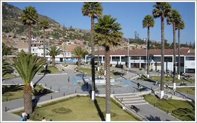
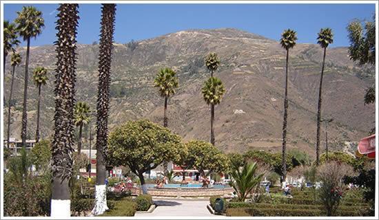
Yungay is a city in north-central Peru, capital of the Yungay Province (Department of Ancash).
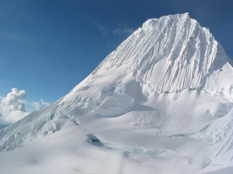
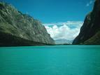
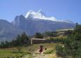
Located 15 kilometers east of the city of Yungay, in the Cordillera Blanca the snow-capped mountains Huascarán, Huandoy, Chopicalqui, Pishqo, Shapraraju, Pirámide de Garcilaso, Yanapaccha, Contrayerba and the lagoons of Llanganuco, Morococha, and lagoon 69 and to the west over the Cordillera Negra, the Tecllo and Qanchiscocha lagoons. Huascarán has a height of 6,768 meters above sea level, is the highest mountain in Peru, and is 1,000 meters higher than Kilimanjaro.
Tourist circuits:
a) Visit Pre-Inca archaeological ruins of the Province: Starting from the City of Yungay you can reach the pre-Inca ruins of Huarca where the Keushu building stands out, which is a ceremonial center where a circular construction of 6 meters in diameter stands out ( 10 KM.), Or you can go to Marcayoc (10 Km.) That presents a temple surrounded by a Pre-Inca citadel, the ruins on the Huamancayan hill, the vestiges of the Huansakay fortress in the ancient city of Yungay; the ruins of Jato Viejo, Kisuar and Collo-Jirca located near Yanama; the ruins of Etzahuain and Orqotunan located between Mancos and Huashcao; Uchuscoto in Cascapara etc. It is important that the Municipality make arrangements with national and foreign universities (Faculties of Archeology), so that they make the corresponding studies about these pre-Inca ruins whose antiquity would be located between 1000 BC to 800 AD and then proceed to their restoration.
b) Revalue the Guitarrero Circuit, which starts very early heading from Yungay to Shupluy, from where, through the black mountain range, you walk north for an hour and until you reach the Cueva del Guitarrero. This cave, together with that of Lauricocha (Huanuco), is one of the oldest vestiges of the presence of Andean man at the time of the beginnings of civilization (10,600 years BC), to which we must add that the Cueva del Guitarrero It is, according to the North American Anthropologist Thomas Lynch (Cornell University), "one of the great testimonies of the origin of agriculture in America." After knowing this Prehistoric refuge, and after taking landscape photographs, the walk towards it will restart, and after crossing a suspension bridge you will arrive at the hospitable town of Mancos, where you will rest, have lunch and take pictures, then in the In the afternoon you will walk back, towards the north, along an old mule track that crosses the towns of Ranrahirca, Huarascucho and you will arrive at Campo Santo de Yungay.
c) On the Yungay - Yanama- San Luís (Cruce) route, east of the town of Huashao and Humacchuco, along the Llanganuco ravine, there is still the old bridle path that the Grand Marshal Andrés A. Cáceres used to reach Yanama, during the war with Chile. On the Yungay - Yanama- San Luís route (crossing), you can take exclusive photographs, and taste the typical food of the place. After reaching the junction of the San Luis-Llumpa highway, you can continue traveling south to reach the City of San Luís where you can rest, stock up and decide to continue the trip to Huari and Chavin or you can decide to go to the north towards the cities of Piscobamba and Pomabamba. Near Llanganuco there is the place called María Josefa, a place where in 1730 a beautiful woman preferred death by drowning in the stream rather than yielding to the urging of a fool who tried to marry her against her will.
d) A beautiful and easy excursion can be made through the YANAPACCHA and DEMANDA GREEK to Laguna 69, located 7 kilometers northeast of the second Laguna de Llanganuco (also called Orko Cocha), from where you walk at heights of 3,950 to 4,620 masl, for approx. 5 hours round trip.
To carry out this excursion, you can start from the city of YUNGAY or from the towns of HUASHAO or HUMACCHUCO, places where you can hire porters and acemilas. From these towns you can start the walk to the Llanganuco lagoons, being able to observe on the route waterfalls, queñuales and multicolored flowers, the impressive wall of the North Huascarán and you will reach the beautiful lagoon 69 located at the foot of the imposing and also beautiful snowy SHAPRARAJU or CHACRARAJU. The ascent to this snowy is only for expert mountaineers with abundant climbing material, because it has walls with an inclination of 70 to 90 degrees and there is danger of avalanches.
Comments
We don´t have yet any comments about:
Yungay, Also Called Yungay Hermosura
Yungay, Also Called Yungay Hermosura
Be the first to leave a comment as it is very important to inform other people
Outros locais a visitar
Within a radius of 20 km from:Yungay, Also Called Yungay Hermosura
Yungay, Ciudad Renaciente y Turistica |
| 1,0 Km |
 |
Alpamayo ´´a montanha mais bonita do mundo´´ |
| 10,0 Km |
 |
Lagoas de Llanganuco |
| 13,0 Km |
 |
Ciudad de Caraz, Caraz Dulzura |
| 13,9 Km |
 |
Cidade de Carhuaz |
| 18,5 Km |
 |
Hotel reservation near Yungay, Also Called Yungay Hermosura within a radius of 20 km

Why to book with ROTAS TURISTICAS
The best prices
Our partnerships with the world´s largest operators offer research on the best market prices.
More options
At Rotas Turisticos you can book the hotel, buy the air ticket, book the transfer from the airport to the hotel and vice versa, book the local excursions, rent the car, take travel insurance and consult the places to visit and where to go.
Holiday Tips & Destinations
Hundreds of holiday destinations with all the options that allow you to easily choose the destination that best suits your dream vacation.
ROTAS TURISTICAS
Links
Follow us on social networks


